

Arrow points to box representing transit centre location.
ETS Infrastructure- Transit Centres
This page will be covering ETS's Transit Centres.
A few notes on the development of transit centres:
Two terms that will be frequently used:
Horizon 2000- New route network and rebranding of ETS launched on June 29,1997.
Most route numbers completely changed.
BNR- Bus Network Redesign, another new network redesign with an entirely new
route number scheme and many significantly changed routes. Includes changes for
the opening of the Valley Line Southeast LRT.
- this is a work in progress, research is ongoing, and initially some of the
dates are based off of when they appeared on Ride Guides we have access to, or
changes noticeable in aerial images from the City Archives, Google Earth, or
Google Streetview.
- Pre-Horizon 2000 Ride Guides refer to "Major Transfer Points". From my
experience for most of my life I interpreted this as "transit centres" as during
the relevant time when I saw a lot these facilities, they were transit centres.
Therefore, I didn't think much of it when Calder disappeared with Horizon 2000.
I assumed the Calder Park N' Ride and the Calder transfer point where the same
thing. Not quite, they were separate. The Calder transfer point was simply the
intersection of 127 St and 129 Ave.
A defining point we are using on the 1980s maps to distinguish transit centres
is how the major transfer points are shown. It seems an arrow pointing to a
street or intersection was likely simply an on street transfer point. If there
was arrow is pointing at a yellow block, then it is a transit centre. Calder was the only on
major on street transit point still on the maps by Horizon 2000, with all others
having become transit centres. With Horizon 2000, it was now only transit
centres shown and Calder had been eliminted.
Some of the on street transfer points are noticeable because they have more
roads than you'd expect to see nearby with bus routes. This was how a bus route
would turn around at the end of it's route. This was eliminated by building a
transit centre where the buses could loop around at, which has also helped in
confirming when a transit centre came to exist.
Examples:
Major Transfer Points that were on street and became Transit
Centres:
Lakewood
Northgate
Millbourne Road/ 76 St (Millgate)
Major Transfer Points that went away over time:
Calder 127 St/ 129 Ave (Before 1980-Horizon 2000)
NAIT Loop 106 St/ 118 Ave (Before 1980-~1985)
| Transit Centre | Open | Closed | Address | Image | Notes |
| Abbottsfield | 1978 | Active | 119 Ave/ Abbottsfield Road |
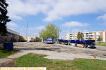 |
1977/78 shows as transfer point of 34 St/ 118 Ave, shows in 1978 aerial image and 1978 Ride Guide as Abbottsfield. |
| Belvedere | April 23, 1978ish | Active | 129 Ave/ Fort Road | Temporary terminal was south of 129 Ave, East of the LRT line. Possible preempt transfer point at 66 St/ 129 Ave 1977/78 Ride Guide. | |
| Capilano | 1977? | Active | 98 Ave/ 57 St |
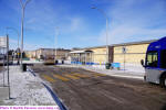 |
Seems to appear on 1977 Ride Guide, clearly shows 1977/78 Ride Guide, not in 1978 aerial image. |
| Castle Downs | 1981 | Active | Castle Downs Road, North of 153 Avenue |  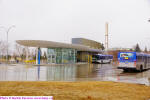 |
1981 Ride Guide |
| Century Park (Heritage) | September 3, 2000 | Active | |||
| Clareview | April 26, 1981 | Active | |||
| Coliseum | April 23, 1978 | Active | 78 St/ 118 Ave |
 |
|
| Davies | September 4, 2022 | Active | |||
| Eaux Claires | August 26, 2011 | Active | GC website | ||
| Government Centre | 1985 | Active | 107 St, North of 98 Ave |
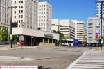 |
Before 1980 there was an off street loop on 106 St south of 97 Ave. Current 1985 Ride Guide. |
| Jasper Place | 1964 | Active | Stony Plain Road/ 157 St. | Rebuilt 1979, 1979 Annual Report | |
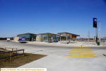
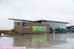
| Heritage Valley | November 30, 2020 | Active | Ellerslie Road and 127 Street |
  |
|
| Kaskitayo | 1982 | September 2, 2000 | 23 Ave/ 109 St | 1982/83 Ride Guide | |
| Kingsway | 1978 | June 28, 2014 | 106 St/ 112 Ave |
 |
1978 Ride Guide, aerial image. Shows as transfer point 1977/ 78 Ride Guide |
| Kingsway/ RAH | June 29, 2014 | Active | |||
| Lakewood | 1982 | Delisted April 24, 2021 | 28 Ave/ West of Lakewood Road East |
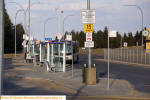 |
1981 as an on street major
transfer point. Shows as TC in 1982/83 Ride
Guide. Remains in use a major off road bus stop. |
| Leger | April 26, 2009 | Active | 23 Ave/ Leger Road | 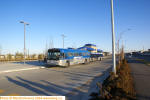 |
|
| Lewis Farms | May 1, 2011 | Active | Spring Service Changes | ||
| Meadowlark | ~1972 | Delisted April 24, 2014 | Meadowlark Road/ 88 Ave |
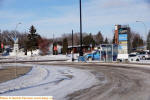 |
Shows on 1972 ETS map. Delisted as TC with BNR, 924 removed February 5, 2022 and closed for WLRT |
| Meadows | April 25, 2010? | Active | |||
| Mill Woods | September 3, 2000 | April 24, 2021 | Hewes Way/ 25 Avenue | 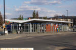 |
Repurposed as recycling centre. |
| Mill Woods VLSE | April 25, 2021 | Active | 2730 Hewes Way | ||
| Millgate | September 1, 1985 | September 3, 2022 | 86 St/ Whitemud Drive |
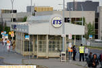 |
Replaced
Millbourne Road/ 76 St which was a major
transfer point starting in
1984. 1984/85 Ride
Guide. Repurposed as recycling centre. |
| Northgate | September 1, 1985 | Active | 137 Ave/
97 St |
Before
1980 as a on street major transfer point. |
|
| South Campus/ Fort Edmonton | April 26, 2009 | Active | 115A St/ 68 Ave | 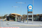 |
|
| Southgate Temporary #1 | 1976 | 1977 | 1976 Ride Guide, 1977 Ride Guide. | ||
| Southgate | 1977, Shelter 12/24/1979 | Active | 111 St/ 50 Ave |
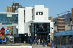 |
1977/78 Ride Guide. Shelter December 24, 1979 1979 Annual Report |
| Southgate 2007 Temporary | July 1, 2007 | Mid-2008 | 111 St/ 54 Ave |
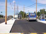 |
|
| Stadium | April 23, 1978 | Active | |||
| University | Before 1978 | Active | 89 Ave/ 113 St |
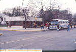 |
|
| West Edmonton Mall (West Jasper Place) | 1981 | Rebuilding for West LRT |
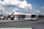 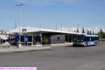 |
1981/82 Ride Guide | |
| West Edmonton Mall Temporary | August 29, 2022 | Active | 90 Ave, 175 St | ||
| Westmount | 1975 | Active | 1975 Ride Guide. Shelter added, opened ~August 1977- EJ August 29, 1977 | ||
| Windermere | Future | Future | |||
| Major Bus Stops | |||||
| Northlands | 1965 or earlier | Borden Park Road/ 76 St |  |
||
| 100 St Southbound | 1971 | 100 St/ Jasper Ave SB |  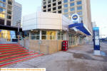 |
||
Major Bus Stops:
CN Tower
Calder- 127 St/ 129 Ave
A note on the use of "Ride Guide". This was the term Edmonton Transit used in the late 1980's through 1990's as the name for their full system map and transit guide. In the earlier years it was just known as Guide XX, with the XX representing the last two digits of the year (ie Guide 82). For simplicities sake, regardless of year, we'll be referring to all of them as "Ride Guides".